
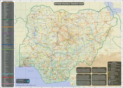
The wall map provides current information on tourism locations, transport infrastructure, capitals, cities, towns, etc. as well as administrative boundaries such as states and country.

Framed Wall Map (140 x 100 cm) printed on glossy paper
₦300,000.00
Related products
-
Laminated Wall Map (140 x 100 cm) printed on glossy paper
₦200,000.00
Reviews
There are no reviews yet.